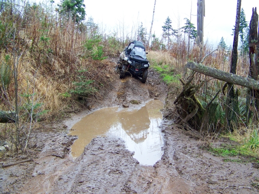
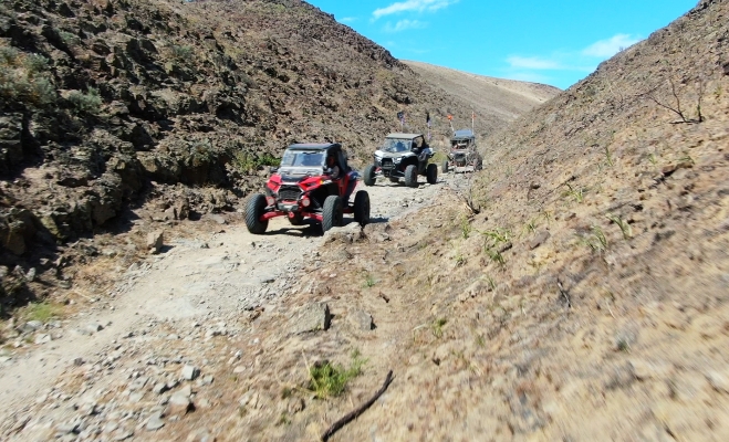
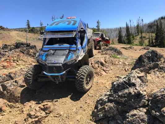
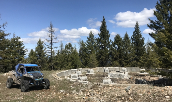
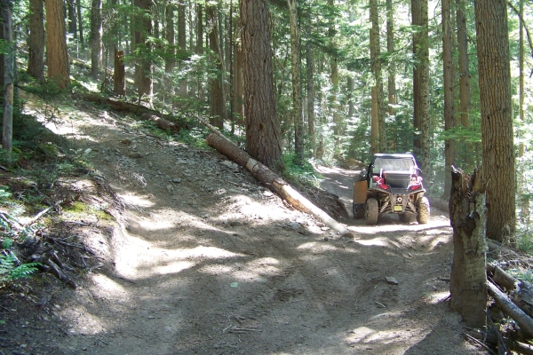
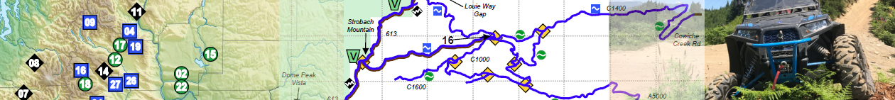
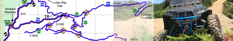
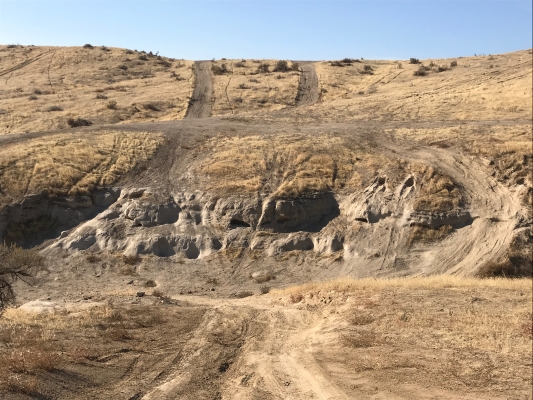
Sadie Creek 4×4 Trail

Located 8 miles west of Joyce, this 4×4 trail is separated by Hwy 112 from the ATV-ONLY Sadie Creek trail system. It is designed for short wheel base (103” or less) off-road vehicles. After passing through a “qualifier gate”, there is a short section of service road, and then the 4×4 trail begins. It is quite a rugged trail, steep and off-camber in places, with deep ruts, and lots of mud.

On a clear day, trail users can see the Strait of Juan de Fuca, Vancouver Island, the San Juan Islands, and Mount Baker.
Highlights: Thick forest, short, steep climbs, muddy ruts. Beautiful views on the highway driving to and from the staging area.

Get details including directions, staging areas, maps, and difficulty levels in the UTV Guide to WA State.

Saddle Mountains

The Saddle Mountains area is just North of Mattawa, WA. It is about 5700 acres of public lands, consisting of mountains covered with small amounts of underbrush and criss-crossed with service roads, mainly along the power lines and leading to communication stations.

This is a good area for a relaxing ride in wide open country. Most of the riding consists of easy gravel roads, but at the Western edge you can find a sandy play area, and some very steep hill climbs. There are a couple of canyons to crawl through, which is the most interesting part.

Get details including directions, staging areas, maps, and difficulty levels in the UTV Guide to WA State.

Rimrock Area 4WD Trails

The Rimrock area is absolutely stunning. There are vistas of exceptional beauty and majesty. And as with most things of great beauty, it is also potentially deadly.

I’m not kidding here. Some of Rimrock is fairly tame and fun to run around on, but a lot of it is crazy steep. I’ve been on trails all over the state and it takes a lot to frighten me, but I still get scared at Rimrock. The side hills are pucker-inducing even when dry. Some of the trails are so steep they are designated one-way only. You’ll slide down them, barely in control. Going up them is asking for trouble. People have died. If you have not grown up off-roading in stuff like this, Rimrock is dangerous.

I’ll rate a couple of the trails as easy, and a few as moderate, but most are double-diamond. Some people will scoff at this, but I can’t emphasize enough, take Rimrock seriously.

Get details including directions, staging areas, maps, and difficulty levels in the UTV Guide to WA State.

Republic Area

This area contains a network of forest service roads in the Colville NF which are legal for all vehicles, and a few actual trails.

The N and SW regions can be accessed by driving your ORV right out of Republic. However, the SE region, which has the best scenery, requires that you trailer your ORV to a staging area. The USFS in this area is rumored to be working on opening all of their roads in this region to WATV use, but at the time of this printing, they had not yet done so.

Highlights:
Fresh pine tree smells. Pretty flowers if they are in bloom. High likelihood of seeing wildlife. Mountain peaks with incredible scenery, 360-degree views. Easy, wide open riding without much risk of crashing.

Get details including directions, staging areas, maps, and difficulty levels in the UTV Guide to WA State.

Reiter Foothills ORV Park

Reiter Foothills was for many years an unmanaged, unofficial riding area with no rules and no maintenance. It was shut down for several years, but has been re-opened. Currently there are only a few miles of trails, but it is steadily growing back into an ORV area of respectable size, with more trail miles added each year.

Trails are being separated out into single-track, ATV, and 4×4. The new trails are very heavily influenced by volunteer participation, and since there are few if any UTV/SxS riders getting involved, the result is that there is not much at Reiter that is suitable for UTVs. That being said, if you’ve configured your UTV as a rock crawler with very large tires, clutching optimized for low speed and thick skid plates, then Reiter Foothills might be great for you! However, if your preferred style of UTV riding is more geared toward high speed and long distances, you won’t find what you are looking for at Reiter.

The ATV trails are not accessible to most UTVs; There is a 50” gate filtering the single road that leads to them. Even if you fit through the gate in your UTV, your longer wheel base will not allow sharp enough turns to stay on the trails.

Get details including directions, staging areas, maps, and difficulty levels in the UTV Guide to WA State.

Quilomene & Whiskey Dick

These areas are part of the LT Murray Wildlife Area. This area provides a desert landscape that is as beautiful as it is harsh, in its own way. You can ride all day here in a large loop with a little bit of backtracking and see canyons, rock formations, rolling hills, windmills up close and personal, and get your feet wet in the river. But by the time you’re done, you’ll be pretty tired because some of this ground can be pretty rocky. You can ride on any road that has a white marker with a green dot on it.
This area is closed from December 15th through April 30th for Elk feeding.

Highlights: Breathtaking views for many miles, including the canyon walls on the other side of the river. Fresh sage brush smells. Pretty flowers if they are in bloom. High likelihood of seeing herds of elk. High speed riding.

Get details including directions, staging areas, maps, and difficulty levels in the UTV Guide to WA State.

Oak Creek Wildlife Area

This area provides a mountain forest landscape, with areas of dense trees and barren ridges. Some of the green dots roads are smooth, some sections are quite rocky. There are a few scenic viewpoints which can be breathtaking in the right conditions. You can ride on any road that has a white marker with a green dot on it.

Large sections of this area are closed in winter to protect wildlife. For best results, visit between May 1 and December 15th. It is likely that there would be too much snow at other times anyway. Highlights: Breathtaking views for many miles. Fresh forest smells. Pretty flowers if they are in bloom. High likelihood of seeing deer and elk. High speed riding.

Get details including directions, staging areas, maps, and difficulty levels in the UTV Guide to WA State.

Naneum Ridge State Forest

This area is fantastic for a full day of smooth cruising around taking in the sights and smells of the forest. Much of it is shaded, so even in the hot summer it’s a great place to visit. A passenger car could drive most of the roads, so don’t expect a challenging ride, that’s not what this area is about. This area provides a nice forest ride up in the mountains with easy access to campsites everywhere, decent views, relaxing, and chilling out.

On Naneum Ridge Rd, the northernmost road, there is an excellent lookout over the Mission Ridge area. There are several points where you can look out over the forest and mountains for many miles. The last couple miles of trail to get up on the ridge are a bit rough. You can ride on any road that has a white marker with a green dot on it.

Get details including directions, staging areas, maps, and difficulty levels in the UTV Guide to WA State.

Naches Pass Trail

In the mid-1800s, a road was made from Walla Walla to Fort Steilacoom through Naches Pass. But it was too difficult for early settlers. It has stayed available for motorized recreation, but has fairly restrictive seasons due to the elevation, and the effects of motorized vehicles on trails (especially when the snow melts). Lower Naches Trail (West Side) is only open July 15th through November 15th. The East Half (#1175 and #684) is open June 15th through November 15th unless posted otherwise.

Steep hill climbs, tricky off-camber terrain on Lower Naches, deep ruts, rocky sections and roots with holes dug right in front of them are pretty much what you can expect to run afoul of here. The good news is that there are multiple trail spurs connecting to FS roads, so if you get in trouble, getting off the trail won’t be too difficult. The trail can be pretty congested at times, and there aren’t a lot of pullouts to let other vehicles pass.

Get details including directions, staging areas, maps, and difficulty levels in the UTV Guide to WA State.

Moses Lake Sand Dunes

Moses Lake Sand Dunes is not a particularly large sand dune area, nor does it have particularly tall dunes. The largest dunes are about 40 feet high, maybe, and there are only a few of these. The area is mainly a handful of open dune areas sprinkled over an area that is covered with crisscrossing sand trails and small hills.

The dunes here are larger than Beverly, and the area is also larger. The area is smaller than Juniper Dunes, and easier to find your way around, with more open sand areas than Juniper, even if the big dunes are not as tall as Juniper. Moses Lake Dunes also has an open sandy beach area so you can go play in the water as well.

In the summer, the Mud Flats opens up, for some variety. That stuff is stickier than it looks, and doesn’t smell great. You have been warned.

Get details including directions, staging areas, maps, and difficulty levels in the UTV Guide to WA State.

Your Virtual Guide to Off-Road Destinations